Category:Christopher Saxton
Jump to navigation
Jump to search
English cartographer | |||||
| Upload media | |||||
| Date of birth | 1540 (statement with Gregorian date earlier than 1584) | ||||
|---|---|---|---|---|---|
| Date of death | 1610 | ||||
| Occupation | |||||
| Notable work |
| ||||
| |||||
Subcategories
This category has the following 3 subcategories, out of 3 total.
C
S
Pages in category "Christopher Saxton"
This category contains only the following page.
Media in category "Christopher Saxton"
The following 47 files are in this category, out of 47 total.
-
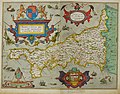
 Cornwall - Christopher Saxton, 1579, 5 - BL.jpg 1,469 × 1,166; 939 KB
-
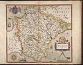
 Bodleian Libraries, Oxonia, Buckinghamia et Berceriae Comitatuum.jpg 1,000 × 675; 173 KB
-

-

-
 Devon - Christopher Saxton, 1579, 10 - BL.jpg 906 × 712; 326 KB
-
 Devoniae Comitat' Rerumquae.jpg 4,041 × 3,625; 3.97 MB
-
 Devoniae Comitat' Rerumquae.tiff 8,081 × 7,250; 102.77 MB
-
 Dorcestriae Comitatus Vicinarumque Regionum nova veraq' Descriptio…. 1575.jpg 4,765 × 3,372; 4.27 MB
-
 Dorcestriae Comitatus Vicinarumque Regionum nova veraq' Descriptio…. 1575.tif 9,529 × 6,743; 106.4 MB
-

-

-
 Farnton Hall, 1577.jpg 838 × 676; 205 KB
-
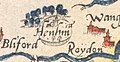 Henham Park, detail from Saxton's Map of Suffolk 1575.jpg 480 × 248; 34 KB
-
-

-

-
 Promontorium …. Proiectum Cornubia dicitur.jpg 4,388 × 3,447; 4.55 MB
-
 Promontorium …. Proiectum Cornubia dicitur.tif 8,775 × 6,893; 105 MB
-
 Radnor Brecknok Cardigan Caermarden Atlas.tif 8,685 × 6,722; 104.36 MB
-
 Radnor Brecknok Cardigan Caermarden Map.jpg 8,685 × 6,722; 21.89 MB
-
 Saxton Anglesey.jpg 762 × 567; 161 KB
-
 Saxton Anglia State II.jpg 1,000 × 772; 173 KB
-
 Saxton Brecknock Cardigan Carmarthen Radnor.jpg 769 × 605; 174 KB
-
 Saxton Denbigh and Flint.jpg 761 × 573; 117 KB
-
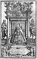 Saxton Frontispiece State 1.jpg 1,323 × 2,073; 2.24 MB
-
 Saxton Glamorgan.jpg 783 × 533; 173 KB
-
 Saxton Monmouth.jpg 763 × 609; 138 KB
-
 Saxton Montgomery.jpg 769 × 582; 164 KB
-
 Saxton Norfolk map Stage II 1583.jpg 4,125 × 2,880; 2.68 MB
-
 Saxton pamberforest.jpg 488 × 266; 173 KB
-
 Saxton Pembroke.jpg 771 × 584; 151 KB
-
 Saxton Somerset uncoloured 1579.jpg 3,000 × 2,339; 1.34 MB
-
 Saxton's Frontispiece.jpg 1,000 × 1,536; 605 KB
-
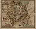
 Saxton's Hampshire 1575.jpg 2,609 × 2,354; 1.69 MB
-
 Saxton's map of Southamptonshire.jpg 1,536 × 1,140; 621 KB
-
 Saxton's Map of Suffolk 1575.jpg 7,759 × 5,786; 9.85 MB
-
 Saxton-Kip map of Essex 1607.jpg 2,000 × 1,591; 2.61 MB
-
 Saxton’s Proof Map of Wales.jpg 4,830 × 5,895; 9.89 MB
-
 Sc Saxton Wiltonia.tiff 8,394 × 7,399; 97.92 MB
-
-
-
 Southamptonia Atlas.tif 8,052 × 7,201; 101.06 MB
-
 Staffordia Atlas.tif 9,013 × 7,023; 95.5 MB
-
 Suffolcia Atlas.tif 8,840 × 6,187; 98.08 MB
-

-
 Warwicum lecestria Atlas.jpg 9,417 × 7,137; 21.97 MB
-
 Warwicum Lecestria Atlas.tif 9,417 × 7,137; 111.22 MB


_Comitatus_(Romanis_Legionibus_et_Colonys_olim_infignis)_vera_et_abfoluta_effigies._Chriftophorus_Saxton_defcripfit._Francifcus_Scatterus_fculpfit_Anno_Dno_1577._RMG_L8558-001.jpg)
_Comitatus_(Romanis_Legionibus_et_Colonys_olim_infignis)_vera_et_abfoluta_effigies._Chriftophorus_Saxton_defcripfit._Francifcus_Scatterus_fculpfit_Anno_Dno_1577._RMG_L8558-002.jpg)


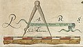
_Comitatus_Regis_Henrici_quinti_nataliys_celeberrimus_Ano_Dm_1577._Chriftophorus_Saxton_defcripfit._RMG_L8559-001_(scale_of_miles_with_compasses).jpg)
_Comitatus_Regis_Henrici_quinti_nataliys_celeberrimus_Ano_Dm_1577._Chriftophorus_Saxton_defcripfit._RMG_L8559-001.jpg)
_Comitatus_Regis_Henrici_quinti_nataliys_celeberrimus_Ano_Dm_1577._Chriftophorus_Saxton_defcripfit._RMG_L8559-002.jpg)


_hec_ob_oculus_ponit_Tabula_Anno_1575_et_D_Elizabethe_Regine_Ao_17.jpg)
